Video on field testing with drone
During the field testing in La Gudiña (Galicia) Eurecat and OHL flow a drone over a viaduct.
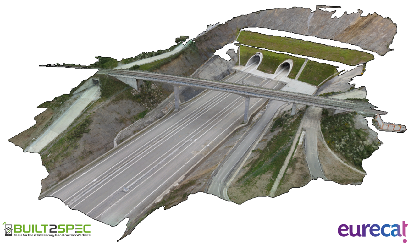
The objective was the use of aerial images for site inspection. A precise 3D reconstruction of the viaduct has been generated from a set of aerial and ground images. This reconstruction will be compared against the BIM model of the site.
The challenge was the planning of an optimal operation to ensure the images of the viaduct were obtained from all perspectives in order to get full coverage of the infrastructure and ensure completeness during the 3D reconstruction process.
The scenario was covered with ground control points (GCPs) to improve the accuracy of the georeferencing process of the images. Furthermore, Eurecat’s drone flew with Real Time Kinematic (RTK) satellite navigation, a technique which improves the global position estimation of the drone. By using both technics, a really good quality of the 3D reconstruction is expected, with errors below 5cm in the georeferenced reconstruction outputs.
Eurecat’s drone, equipped with a DLSR camera, performed four different flights, two flights with a grid pattern over the viaduct, at 30m and 40m of altitude, and two frontal and rear flights at 30m.
© Autonomous Systems – Eurecat Technology Center
All flights were performed successfully (follow the video link below). The image below illustrates the results of the 3D reconstruction. During the following weeks the 3D reconstruction will be analysed and compared with the BIM model provided by OHL.
Back to Overview