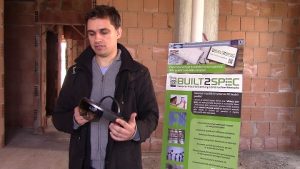
On-site tests in Italy
The Italian organisations De5 and R2M, the Swiss University ETH Zürich and the National University of Ireland Galway have just finished their on-site tests at the DE5 demo site, Rigolizia located in San Salvo (Abruzzo region, Italy).
 The tested technologies include:
– Drone surveys
– Hololens survey
– Google Tango survey
– Standard pics survey (by using GoPro videos)
– 3D Lidar
All technologies tested on-site help to transform and accelerate advances in the construction industry in order for the sector to become more accurate. The partners identified the innovations relevant to them, “we will fully embrace the innovative opportunities of these technologies in our existing day-to-day operations in order to improve our organisation and business model” says Guiseppe D’Aulerio from DE5.
Objectives
The two main goals of these activities are:
1. BIM reconstruction: from a survey we get the 3D Point Cloud by using ad hoc codes/algorithms and convert it manually into Building Information Modelling
2. Comparison of the geometry entities to monitor progresses and/or construction errors by comparing:
– two different 3D Point Clouds taken in different time-lapses
– converted 3D Point Cloud into BIM
– convert BIM into 3D Point Cloud and compare with scanned 3D Point Cloud
Result
The tests carried out provided a very interesting overview of the benefits from these technologies. These are substantially different with respect to acquisition time, post processing time and output quality, as well as hardware costs. The particular choice should be adapted to requirements of a particular task and the final purpose of the acquired 3D data.
Future scenarios for imagery tools
Scenario A: A designer starting a new retrofit project wants to have a BIM model of an existing building, therefore the designer needs 3D Point Clouds
Scenario B: For the visual quality inspection by a general contractor site supervisor a contractor needs to compare the current state of progress with a benchmark. Once the 3D Point Cloud has been generated by using the above technology, the contractor can:
– compare the “scans” (Point Cloud vs. Point Cloud; BIM vs. Point Cloud) – the accuracy will depend from the acquired data
– visualize the “scans”, “scans” comparison or BIM either offline using an image or 3D model on a computer screen, or online (for small applications – e.g. 1 room or 1 apartment) by using HoloLens as a hologram at 1:1 scale.
Scenario C: A public authority wants to verify compliance with the submitted BIM design for planning permission – the same approach seen above at point “B” can be replicated.
Back to Overview